GeoDroid Mapper 1.00
Free Version
Publisher Description
GeoDroid Mapper is a geological digital field notebook application that allows the user to collect and store lithologic, geotechnical, structural, positional, and datum information in a variety of input formats. Common lookup lists are used for lithologic and structural data (planar and linear features); a new lithologic manager allows custom, user-defined, lookup lists from an extensive library of igneous, metamorphic, and/or sedimentary rock types; text and camera inputs are available for recording additional observations and notes at each outcrop.
The relational-database is organized in a one-to-many format to allow for complete flexibility regarding the number structural measurements necessary at each map station. The need for external GPS receivers is eliminated; as the device's internal GPS unit is used for northing and easting data.
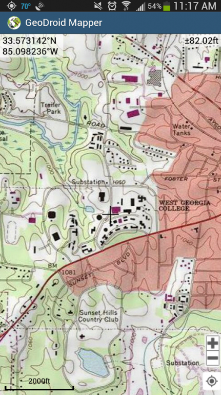
GeoDroid Mapper is integrated with the ESRI ArcGIS Android library to plot and display map station numbers on an interactive base map. Long tapping at the GPS point or the Cross Hair allows for new data to be entered into the database. Once entered, tapping the map station icon launches a viewing window to review, edit, and/or add to your recorded data. Within the viewing window, the user can tap an edit button to make necessary edits of the record set.
Features:
- ESRI ArcGIS Android library
- ESRI ArcGIS topographic, aerial, and highway base maps
- USGS library of all 7.5-minute quadrangles in the United States
- Lithologic manager and customization of rock type lookup lists
- Common structure input formats (dip/dipdir, AzimuthR, Quadrant)
- Metric and Imperial inputs
- Geotechnical characteristics including weathering index, strength index, and layer thickness
- Onscreen editing and review of existing data
- Export of SQLite database for ESRI ArcGIS or Autodesk Map 3D applications
- Flexible database format- quadrangle, map station, and structural readings
- Pictures at individual map station
- Multiple coordinate formats (DDMMSS.SS, DDMM.MM, DD.DDD, UTM)
About GeoDroid Mapper
GeoDroid Mapper is a free app for Android published in the System Maintenance list of apps, part of System Utilities.
The company that develops GeoDroid Mapper is WolfBytes Software. The latest version released by its developer is 1.00.
To install GeoDroid Mapper on your Android device, just click the green Continue To App button above to start the installation process. The app is listed on our website since 2014-05-22 and was downloaded 8 times. We have already checked if the download link is safe, however for your own protection we recommend that you scan the downloaded app with your antivirus. Your antivirus may detect the GeoDroid Mapper as malware as malware if the download link to edu.uwg.wolfbytes.geodroidmapper is broken.
How to install GeoDroid Mapper on your Android device:
- Click on the Continue To App button on our website. This will redirect you to Google Play.
- Once the GeoDroid Mapper is shown in the Google Play listing of your Android device, you can start its download and installation. Tap on the Install button located below the search bar and to the right of the app icon.
- A pop-up window with the permissions required by GeoDroid Mapper will be shown. Click on Accept to continue the process.
- GeoDroid Mapper will be downloaded onto your device, displaying a progress. Once the download completes, the installation will start and you'll get a notification after the installation is finished.
